A465 Heads of the Valleys, Wales, UK
This Great Road, written by Kieron Fennelly, was initially published in issue 62 of Total 911.
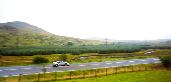
We tend to think that the best roads are routes we have to seek out, but the A465 (which bisects south Wales) is one you would use anyway, except that relatively few people do. This is odd. The A465 is, after all, part of the trunk road network, yet traffic seems to avoid it, even though it offers a fast mixture of single and dual black top which links the A40 at Monmouth with the M4 at Swansea.
The Heads of the Valleys road, as it is known, is the dividing line between the uplands of central Wales and the fissured landscape of south Wales whose valleys contained mineral wealth and brought about the industrial development of the 19th Century. Getting iron ore and coal out led to road and rail links which focused on reaching the ports of Cardiff and Newport.
However, east-west connections were neglected as few people needed to go far in those directions. If you lived in those valleys it meant that driving to west Wales for holidays in the Sixties took the best part of a day. You could get to London faster!
Then in 1966, the Severn Bridge opened and soon the M4 cut a swathe across the principality and you sailed across south Wales without even seeing it. 40 years on, the M4 is still the default route but, more often than not, it is a drive of some tedium.
Meanwhile the logical alternative, a road which would also provide a more direct connection with the Midlands, was constructed. This was the A465, which sought to link a series of local roads into a coherent highway. However, the project has been mired in political differences over funding and the result is an uneven mixture of dual and single carriageway along its 44-mile length.
This includes three-lane stretches over blind brows which can serve up dramatic overtaking manoeuvres, but it is the very incomplete nature of this route which makes it so interesting.
LATITUDE: 51:66:61N/3:80:53W LENGTH OF DRIVE: 44 miles POINTS OF INTEREST: FOOD AND ACCOMMODATION: Penrhadw Farm, Pontsticill
Old railway viaduct (and walk), Merthyr Tydfil
Big Pit National Mining Museum, Blaenavon, Gwent
Brecon Beacons National Park
Walnut Tree Inn, near Abergavenny
www.thewalnuttreeinn.com
www.penrhadwfarm.co.uk
Travelling towards London, you leave the M4 at junction 43, Neath. The nearly empty dual carriageway of the A465 is an encouraging start, offering fast progress punctuated by a handful of roundabouts. Then you drop a gear as the route starts to climb and you realise that you are going to the top of that mountain in front.
Off the roundabout at the Hirwaun turning, there are 11 miles of three lane across desolate moorland before Dowlais Top, the highest point on the route at 1,200ft where the dualling begins again. But this rising, curving A road is absorbing your full attention as you take advantage of the overtaking lane to pass other traffic.
Another roundabout and again the sheer pleasure of accelerating through four gearchanges and the chance to glance right at fine views of Merthyr Tydfil with the impressive stone viaduct of the Brecon & Merthyr railway in the foreground.
A few more miles of dual before the A465 is singled again, but it simply entails travelling slower as the route swoops down towards Tredegar up gradients no longer permissible with modern road building.
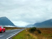
Turn off onto the B4560 to Llangynidr, as it leads to the loop of unclassified roads around Llangattock beloved of the road testers. Driving this stunning ten-mile circuit is what your 911 was built to do.
Returning to the A465, you’ve reached the A40 and an easy run to the M5 or, if returning to the M4, the B4598.
No more than a dozen miles further than the motorway, this Heads of the Valleys route provides challenging and varied scenery and the feeling that the journey was just as worthwhile as the destination.


More from Total 911

Video: 100 Porsche 911s cross Sydney Harbour Bridge
A82, Glencoe, UK

‘Evo Triangle’, North Wales, UK

Comments (0)