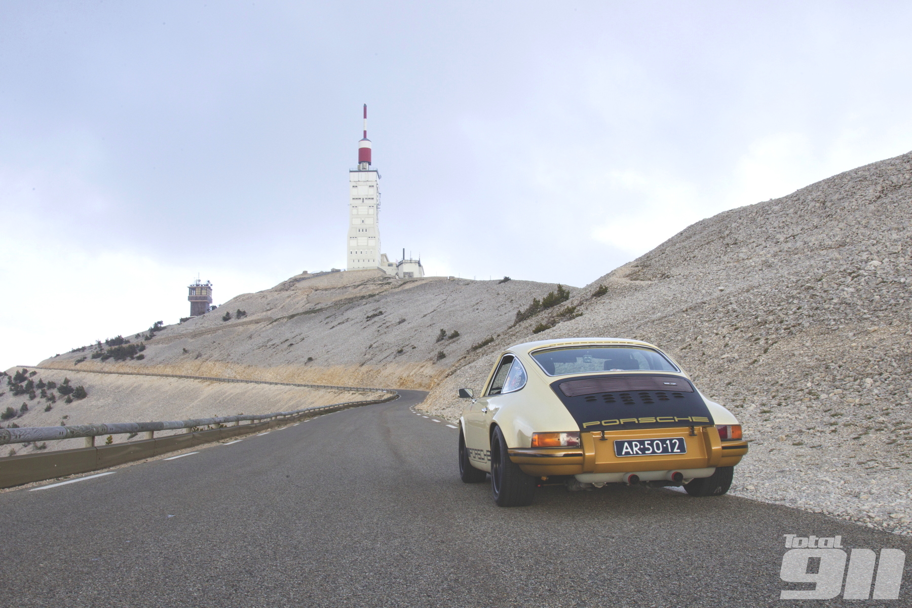
D974, Mont Ventoux, France
The top of the infamous Mont Ventoux, known as the Giant of the Provence, can be entered from three directions. The 1,911-metre-high mountain in the French Vaucluse is well known for its difficult stages in the Tour de France, where the racers often enter it from the steepest side, where the village of Bedoin lies.
The name comes from the Occitanian word ‘vent’ meaning wind and it’s dedicated to Vintour, the Celtic god of the wind. No wonder, because wind speeds of over 300 kilometres per hour have been measured at the top of the Ventoux.
The area is extremely popular in the cycling scene, and you can imagine it’s swarming with tourists and cyclists during the summer months.

We made the trip in early June and started the drive around 7pm, when it was quiet. We saw maybe three cyclists during our drive up, and on the top by the weather station, one single camping car was spotted.
We’d therefore say the best times to go up these roads would probably be June and September when the weather is good and when there are not too many people around. It gives you a chance to open up the throttle a little bit more in your 911 on the perfectly smooth tarmac.
A little bravery comes in handy because guardrails are nowhere to be found at most points, and there are quite a few tricky hairpins to be found.

Latitude: 44°10’28″N, 5°16’44″E
Length of drive: 26 miles
Points of interest:
Epic views from the top of Mont Ventoux; plenty of wineries with famous Ventoux wines along the way; visits to the beautiful lavender fields in the Ventoux area.
Food and accommodation:
Malaucene and Bedoin have a variety of hotels and restaurants with amazing dishes from an authentic French menu
Malaucene is located west of the mountain and from there the D974 takes you all the way to the top. Going down the mountain again on the other side, passing the Tommy Simpson monument in the so-called ‘Moon landscape’, the D974 will take you back southwest to Bedoin.
A few miles under the top at an altitude of 1,440 metres you will see Chalet Renard where the D164 can be taken east, to the village of Sault, the third access road to the top of Mont Ventoux.
This area in the French Provence is amazing to drive, with mind-blowing views and a beautiful countryside. Just make sure that if you’re a fan of slightly higher speeds, you go here during the off-season months of the year.


More from Total 911
2015 Tudor USCC: Long Beach race report

Video: Porsche 918 Spyder flat out in the outback

The Total 911 team’s dream £100,000 Porsche 911 garage

Comments (0)